Crabeater Seal
Least Concern
IUCN Red List of Threatened Species
Data
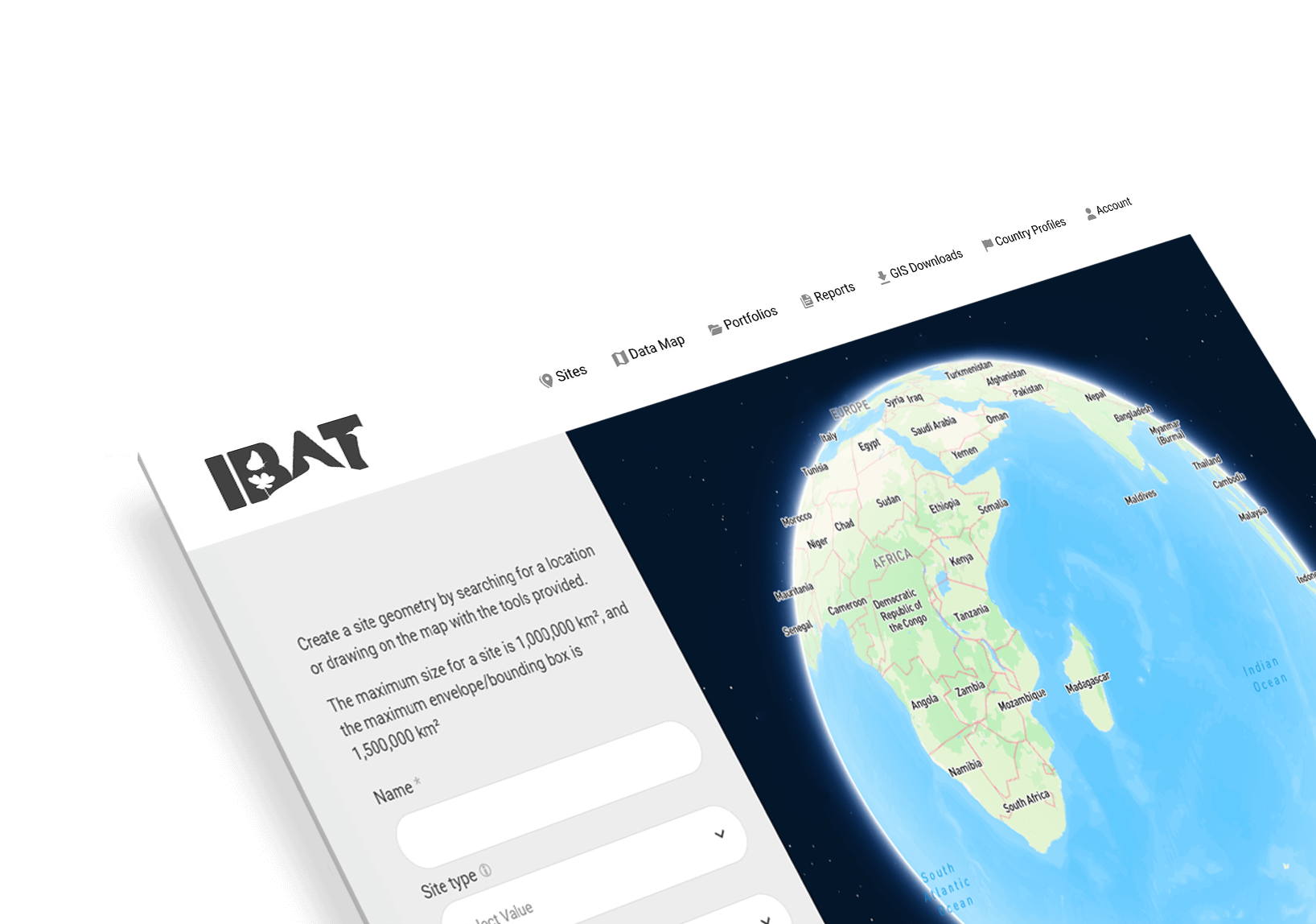
IBAT hosts and maintains three key global biodiversity datasets.
IBAT hosts and helps maintain three key global biodiversity datasets.
The three datasets in IBAT are used for international reporting purposes, including United Nations tracking of progress towards the 2030 Sustainable Development Goals (indicators 14 & 15), core indicators of the Intergovernmental Science-Policy Platform on Biodiversity and Ecosystem Services (IPBES), and other international assessments such as the Global Biodiversity Outlook. Beyond global reporting, IBAT data is essential for organisations looking to assess biodiversity risks, align with sustainability frameworks, and meet regulatory and disclosure requirements. It helps integrate biodiversity considerations into decision-making, impact assessments, and supply chain management.


IUCN Red List
The IUCN Red List of Threatened Species (also known as the IUCN Red List), is a rich compendium of information on threats, ecological requirements, and habitats of over 160,000 species; and on conservation actions that can be taken to reduce or prevent extinctions.

African Wild Dog
Endangered
IUCN Red List of Threatened Species

Retezat National Park
World Database on Protected
and Conserved Areas (WDPCA)

World Database on Protected and Conserved Areas
The World Database on Protected and Conserved Areas (WDPCA) combines the World Database on Protected Areas (WDPA) and World Database on Other Effective Conservation Measures (WD-OECM) into a single World Database on Protected and Conserved Areas.
The database is a joint project between the UN Environment Programme and the International Union for Conservation of Nature (IUCN). Data and information in the WDPCA underpins the publication of the United Nations List of Protected Areas.
World Database of Key Biodiversity Areas
Key Biodiversity Areas (KBA) are the most important places in the world for species and their habitats.
The KBA network includes ‘sites contributing significantly to the global persistence of biodiversity’, in terrestrial, freshwater and marine ecosystems.
Please note that sensitive KBAs are not listed in IBAT.

Great Barrier Reef
UNESCO World Heritage Site
World Database of Key Biodiversity Areas

Sumatran Orangutan
Critically endangered
IUCN Red List of Threatened Species
Species Threat Abatement and Restoration metric
The Species Threat Abatement and Restoration (STAR) metric is a science-based tool designed to measure, in a spatially explicit way, the potential reduction in species global extinction risk that could be achieved through conservation action and restoration.
Built on data from the IUCN Red List of Threatened Species™, STAR quantifies how much global species extinction risk could be lowered through actions taken at a particular site or collection of sites, such as a company’s footprint, or even an entire country.
STAR provides a consistent approach to set extinction risk reduction targets both locally and globally, transparently making progress measurable and comparable.
Rarity-weighted species richness
Rarity weighted richness is a measure that combines endemism and species richness of amphibians, birds, mammals, reptiles and a representative set of plant taxa in each 10 km cell.

I'iwi
Vulnerable
IUCN Red List of Threatened Species
Testimonials
Hear what our users have to say...
"IBAT provides an excellent pre-screening desktop resource to be used in these assessments focusing on species, habitats and legally protected and or internationally recognised areas of biodiversity importance."
"The outcomes have served several purposes from the CSRD disclosure to the launch of specific biodiversity conservation projects. IBAT is a powerful tool which has definitely help LVMH and its Maisons making the biodiversity Group’s strategy more reliable and science based.”
"IBAT provides up-to-date information on protected area designations and threats to habitat and biodiversity. These data inform the BeZero Carbon Rating, an assessment of the likelihood that a carbon credit delivers on its promise to achieve a tonne of CO2e avoided or removed."
"IBAT has been an essential tool to help Evonik understand our biodiversity risks and opportunities on-site."
"IBAT also allows me to integrate my analysis with other GIS tools, which increases the depth of my scrutiny. We are looking forward to utilising the new STAR functionality!"
"IBAT provides essential screening on threatened species and endangered habitats that helps us assess risks, focus accompanying investigations, and prioritise restoration activities at our operating sites globally."

Learn how IBAT can transform your relationship with data and support your nature-positive goals